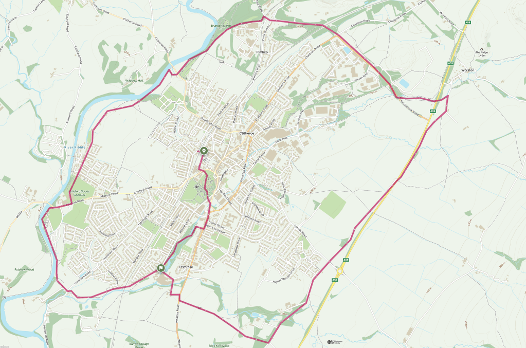
Activate Clitheroe has created a largely traffic-free walking route around Clitheroe, stretching from Pimlico to Standen and Worston to Low Moor.


It’s almost 14km or 8.5 miles long and should take around 4 hours to complete and it’s a great way to get to explore Clitheroe on foot.
This route starts and finishes at Clitheroe Station and joins the circular route in a clockwise direction from the end of Woone Lane, but you can join it at any point along the way.
In the medium term, we want to improve signage and make it stile-free and accessible to all.
Local residents can help us refine this route by suggesting improvements. We also want to create some ‘spokes’ leading from the circular route into the centre of town.
While sections of this route are already suitable for cycling and wheeling, ultimately, we’d like to make the entire route accessible to walkers, cyclists and wheel chair users.
What do you think? Get in touch to let us know via the button below

Leave a comment