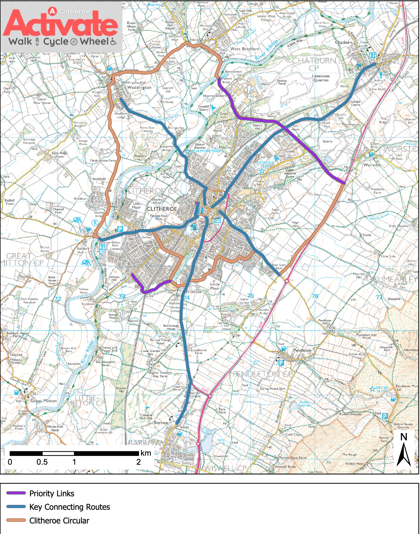
This map shows the active travel corridors that connect up Clitheroe’s residential areas with the town centre.
It’s very much a work in progress, but with your involvement, we can make it better and more useful.
If you have any updates or suggestions, please get in touch with us to share your ideas and improvements.
Ultimately, Activate Clitheroe wants to create a comprehensive network of safe walking/cycling/wheeling routes which connect up Clitheroe Town Centre with all the residential estates and surrounding villages.
NEW! Clitheroe Circular Walk
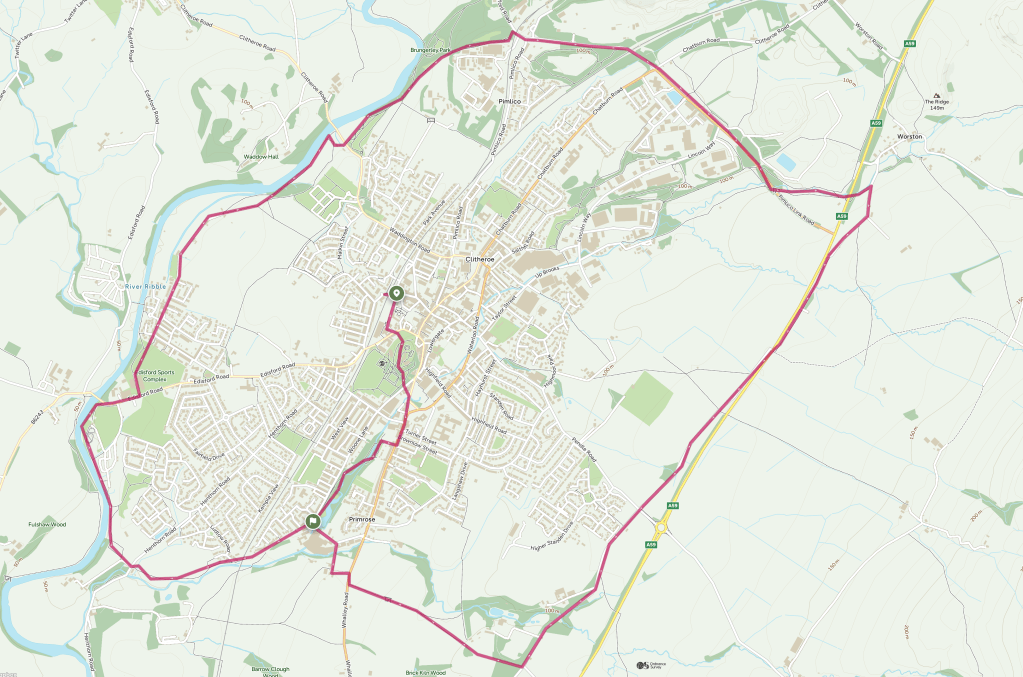
We’ve created a Circular Walking route around the entire town – stretching from Pimlico to Standen and Worston to Low Moor.
It’s almost 14km or 8.5 miles long and should take around 4 hours to complete and it’s a great way to get to explore Clitheroe on foot.