We’ve created a largely traffic-free walking route around Clitheroe, stretching from Pimlico to Standen and Worston to Low Moor.


It’s almost 14km or 8.5 miles long and should take around 4 hours to complete and it’s a great way to get to explore Clitheroe on foot.
In the medium term, we want to improve signage and make it stile-free and accessible to all.
Local residents can help us refine this route by suggesting improvements. We also want to create some ‘spokes’ leading from the circular route into the centre of town.
While sections of this route are already suitable for cycling and wheeling, ultimately, we’d like to make the entire route accessible to walkers, cyclists and wheel chair users.
What do you think? Get in touch to let us know via the button below
Turn-by-turn directions
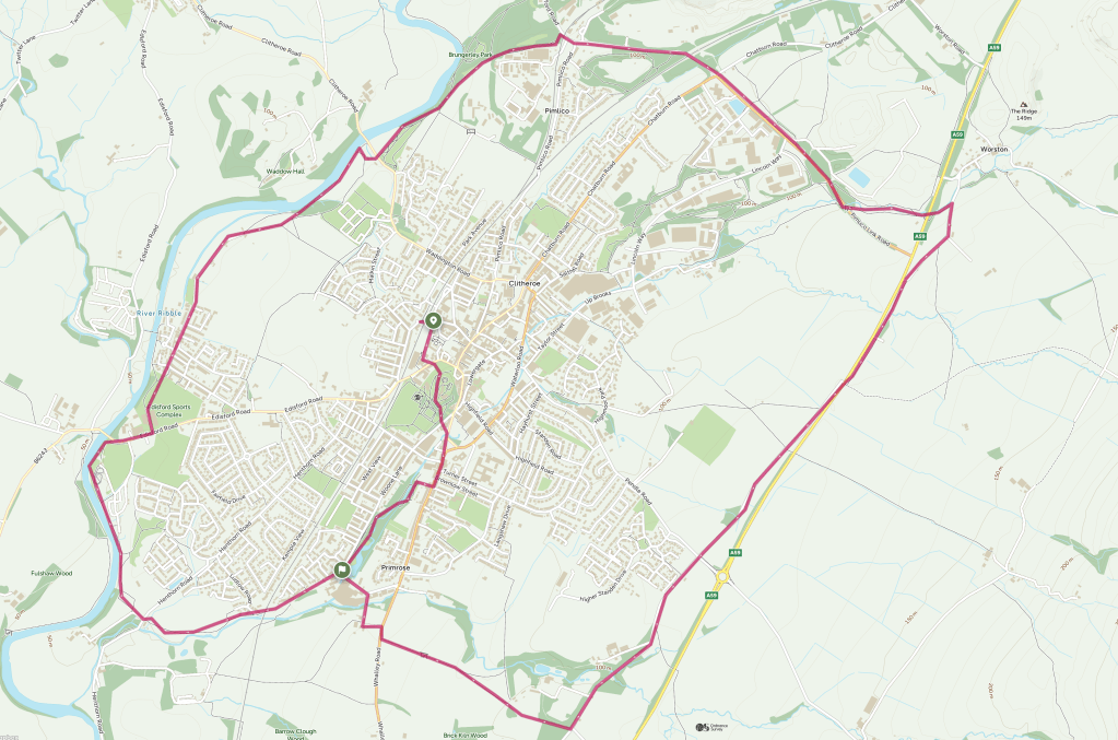
This route starts and finishes at Clitheroe Station and joins the circular route in a clockwise direction from the end of Woone Lane, but you can join it at any point along the way.
START: CLITHEROE STATION
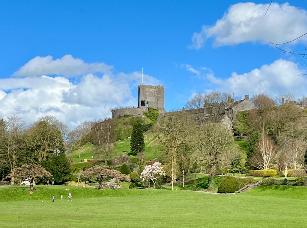
Turn right out of station and continue past the supermarket, following the road round to the left then, at the roundabout, head right, but instead of crossing the railway bridge, veer slightly left down lane leading into the castle field.
Continue under the footbridge then left, climbing steadily past the bandstand and continuing to exit the grounds opposite the Brown Cow pub.
Cross the road with care and beyond the pub, head right, turning right again after 50m into the Holmes Mill complex. Continue through the complex and exit past hotel onto Greenacre Street and head left past school then right along Whalley Road.
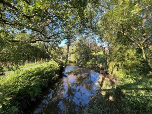
After 150 yards head left down cobbled lane between pub and Chinese restaurant. Follow lane to left then immediately right and follow path left into nature reserve. Cross the wooden bridge over Mearley Brook then follow path left.
Continue past next bridge following the walkway and climbing the steps to exit onto Woone Lane near the owl carving. Cross the road with care and head left along Woone Lane. Where the road turns sharp left, continue straight on along tarmac driveway into the new development.
You are now on the Circular Footpath
Continue past the apartments and through gate onto gravel track. Go through another gate and continue under the railway viaduct. Beyond the viaduct, continue alongside the stream then across the fields to the lane.
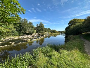
Cross the lane and continue on track other side as it swings right then left through gate and through the trees to join the path alongside the River Ribble.
Continue upstream to Edisford Bridge and head right onto footpath which runs alongside road. At the swimming pool, cross the road with care and follow access drive between pool and padel courts.
At end of drive, continue along the treeline running parallel to the river and along the backs of the houses. Just before reaching the footbridge over the river, turn right and continue over the mini roundabout then left through the housing estate and onto gravel track.
Continue past the allotments and after the gate beside the stables, keep left and continue past the weir then through woods and across the field to Brungerley Bridge.
At the bridge, climb the steps and cross road with care then take tarmac path on left into Brungerley Park. Stay on the tarmac path through the park for 600m to reach the road next to the railway serving the cement works.
Head left across the railway and cross the next road and continue along the grassy verge and over another railway line on bridge. At the roundabout, cross with care and continue on pavement past the hospital and on to Deanfield.
At Deanfield, continue on pavement up Pimlico link Road, then into Lincoln Way and almost immediately left to join path around perimeter fence of Dugdale Nutrition.
Follow perimeter path to junction of footpaths and head half left through gate. Continue downhill and cross stream then left through gate and up to road.
Cross road with care and continue through field heading along left hand side of the field towards Pendle Hill. Continue past the footbridge and straight on over the stile to the A59.
Cross the busy A59 with care and join the footpath heading left to join the quiet lane. Turn right along the lane to join the surfaced path running parallel to the A59. After 500m, follow path right and recross the A59 with care to join the quiet lane on the far side running parallel to the A59.
Continue along this lane for just under 1km to crossroads. Cross with care and continue straight on past the new housing estate. Light traffic uses this road so take care.
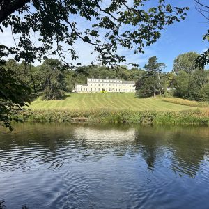
Continue along lane for 750m, crossing the bridge and passing driveway to Standen Hall. Immediately after the junction, beside the bench, take track on right.
Follow this track to a gate and head left through gate and continue straight ahead across the field towards the stand of mature oaks. Continue through the gate and continue along field boundary and through another gate to reach the main road.
Cross with extreme caution as the sight lines are restricted and head right on pavement then left along farm access drive and right through the farmyard onto another track.
Cross the stream and at road turn left and continue along pavement, over the bridge and follow road round to the right to reach Woone Lane.
///TO RETURN TO THE STATION:
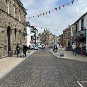
Continue along the lane, heading toward the castle and at cross roads continue straight over. Join Moor lane continue through the town centre, turning left at the crossroads before the library and walking down King Street to return to the station.
FREE DOWNLOAD
You can download the route from OS Maps and OutdoorActive below – just click on your preferred option to go direct to the route.